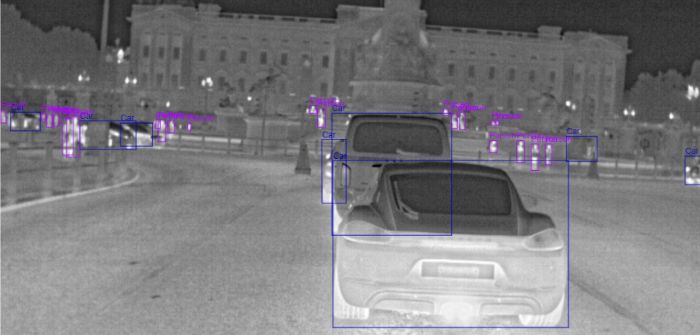
FLIR Systems has made its first European thermal imaging regional dataset available in Europe.
Designed to speed up development of ADAS, AEB and AV systems, the dataset has thousands of annotated thermal images of daytime, night-time and various weather scenarios from six European cities.
The European dataset has images from London, UK; Paris, France; and the Spanish cities of Madrid, Toledo, Granada and Malaga.
They were taken in a variety of driving environments in each city and are similar to previously released thermal imaging datasets for San Francisco and Santa Barbara in California, USA.
The two previous datasets have been downloaded 5,000 times and the new images and videos will be added to the library to speed up convolutional neural network training of thermal data.
Mike Walters, vice president of product management thermal and machine vision cameras at FLIR Systems, said, “To help make roads safer, the combination of thermal imaging and AI with visible light cameras, lidar and radar allows auto makers to create more comprehensive and redundant systems for identifying and classifying roadway objects and pedestrians.”


