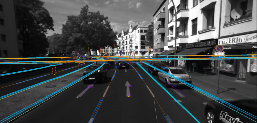
German 3D mapping company Atlatec has announced that it is making its demonstration maps and data for use in autonomous vehicle programs available publicly – even to competitor businesses.
Atlatec deliberately avoids the use of lidar to make map records, instead recording data captured by a GPS antenna with dual cameras to generate what the firm claims is a superior 3D map that can be used by autonomous vehicles. The company maintains that this method offers higher fidelity map quality, and the method of its data capture can be carried out at a fraction of the cost of lidar.
The Karlsruhle-based German firm hopes that by making its data available to all, it can gain exposure to potential customers, notably in automotive and tech hotbeds in the USA. In an interview with Forbes, Atlatec CEO Henning Lategahn said, “We think those competitors which are really keen on getting their hands on our data will find it anyway. I’d rather go out there and show it to the competition.”
“We’re putting this out there in a range of formats [so] that people who drive on these roads, potentially for their real world tests, can just download from our website, feed into their tech and really put it to the test. There are not many data sets out there that contain maps of that fidelity and maps of that richness and we thought it’s a good idea to share this with the community.”
The avoidance of lidar, according to Atlatec, means relying on camera scans to pick up surroundings, which can capture more data. This is when the company calls on artificial intelligence to recognize calling points such as traffic lights or signs to set their proximity and location. This data is used to generate a map, which is then refined by human eyes to detect errors. An interactive top-view map allows for editing.
Atlatec business development manager Tom Dahlström also told Forbes, “In the Bay Area there’s lots of mobility companies that are looking to get their AV tech to take off, so there’s not only lots of customers but also lots of potential competitors out there because some companies build their own maps so you have to kind of compete with the do-it-yourself option and therefore it’s interesting for us to put this out there as a proof of concept.”


