AAVI recently caught up with Curtis Hay to discover how he develops precise GNSS, V2X and map technology to enable safe and reliable operation of GM automated vehicles. (You can read the magazine version of this interview, here.)
Tell me a little about your background and your current work at General Motors.
I spent eight years as a US Air Force officer, working entirely in GPS. I deployed GPS receivers on military weapon systems and had two military assignments doing GPS satellite launch planning and GPS operations. I separated from the military and joined General Motors in 2001, right before 9/11. At GM I was part of the growing OnStar organization and on the team that led OEM deployments of wirelessly connected vehicles. That was an exciting time in the auto industry, and it was gratifying to break new ground every day with new innovations. I briefly left GM in 2005 to work for John Deere for four years. At John Deere I deployed precise GPS and IMU technology into farm equipment and construction equipment to increase automation. In many ways, the agriculture industry was first to market with automated features such as AutoTrac – enabling farmers to take their hands off the steering wheel in their tractors.
As a technical fellow at GM, I now work on developing precise GNSS, V2X and map technology to enable safe and reliable operation of GM automated vehicles. Previously, I led the team responsible for launching GM’s 4G LTE connectivity in North America, Europe and China.
You’re speaking on Day 1 of the ADAS & Autonomous Vehicle Technology Expo Conference in California. What is your presentation about?
Automated vehicles must be ‘localized’ to their environment. This requires an accurate understanding of the vehicle pose – including knowledge of vehicle roll, pitch, yaw and delta velocities along three axes of motion. Vehicle pose is determined with sensors. Sensors fall into two general categories: Absolute, meaning vehicle location is established relative to a global Earth reference datum; and Relative, meaning vehicle location is established relative to fixed objects along the roadway. Inertial measurement unit (IMU) sensors can be used for both Absolute and Relative positioning, which makes them a flexible and critical part of any automated vehicle localization system. Unfortunately, low-cost motion sensors suffer from unwanted effects such as long-term drift and short-term noise. This presentation focuses on the expected benefits of automated vehicle localization with improved IMU sensors, including reduced computational burden and better performance in challenging environments such as dense cities, tunnels and parking garages.
What are the benefits/advantages of inertial sensors in automated driving?
Inertial sensors have many benefits. They allow continued vehicle positioning when GNSS satellite signals are blocked; they sense vehicle acceleration along curved roads; they supplement camera and radar sensors to measure relative motion; they provide vehicle motion measurements to support maneuvers such as automated lane changes and automated parking; and they sense vehicle heading for map matching and compass indicator.
How do these sensors contribute to automation in challenging environments?
GNSS satellite signals suffer in urban conditions and tunnels. In these environments, satellite signals can be reflected off man-made structures, which reduces accuracy – or these signals can be blocked entirely. If the IMU sensors are properly calibrated prior to degradation of GNSS signals, the IMU can continue to accurately localize the vehicle for an extended period of time until healthy GNSS signals are reacquired.

How critical is precise GNSS, V2X and map technology to enable safe and reliable operation of GM automated vehicles?
Most OEMs use a high-definition map in some form for automated driving. Attributes in this map, such as lane lines and intersections, are generally expressed in an absolute reference datum such as WGS-84. The location of the vehicle can also be expressed in the same global reference datum, enabling an important function called ‘map matching’. The key sensors to enable map matching are GNSS satellite radio-navigation, wheel odometry and the IMU. Map matching to enable safe and reliable automated driving would not be possible without these technologies. V2X wireless communication has had a rocky and slow deployment history in the US but offers potential as an additional sensor to detect locations of adjacent vehicles once OEM deployments gain sufficient traction.
What are some of the key requirements and design trade-offs for inertial sensors?
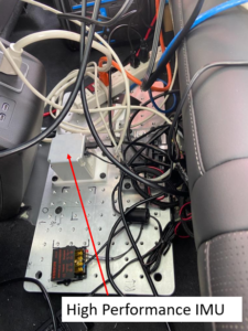
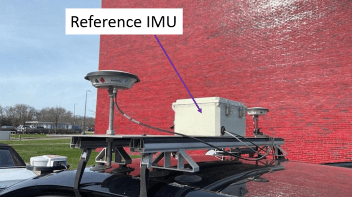
Inertial sensors fall into two categories: rate sensing and delta-velocity sensing. Rate sensing is done with a gyroscope and Delta-V sensing is done with accelerometers. Higher-quality IMUs generally have six degrees of freedom, meaning three gyro axes (roll/pitch/yaw) and three acceleration axes (X/Y/Z). The most important axes for automated driving are yaw (vehicle heading) and lateral/longitudinal delta velocity. There is a lot of R&D occurring across the globe to minimize noise characteristics of gyro and accelerometer sensing while maintaining low cost. The preferred technology for inertial sensors is micromachined electromechanical sensors (MEMS) because of the maturity and reliability of the industry – and their low cost. The most publicized performance parameters being optimized by MEMS manufacturers are gyro bias stability and gyro short-term noise, also called angular random walk. By improving upon these two performance parameters, the IMU offers the potential to offset other costs in vehicle localization, including shifting CPU computational burden away from localization based on perception.
 What do you hope delegates will take away from your presentation?
Automated vehicles require a thoughtful method to compute location – both in a relative and an absolute sense. An overlooked component with automated vehicle localization is the IMU. With important IMU innovations on the horizon, OEMs have an opportunity to optimize the localization architecture to improve performance and reduce cost.
Why did you choose to speak on this topic at ADAS & Autonomous Vehicle Technology Expo Conference California?
I’ve spoken at this ADAS expo event several times. It’s always a good forum to meet new people and to get a clearer sense of what is happening in the global auto industry.
Don’t miss Curtis Hay speaking on August 28 at the ADAS & Autonomous Vehicle Technology Expo Conference in San Jose (rates apply). The expo is free to attend. Click here to find out more.


