GeoMate and dSPACE have entered a partnership to accelerate the development of ADAS and autonomous driving technologies in continuously expanding operational design domains (ODDs).
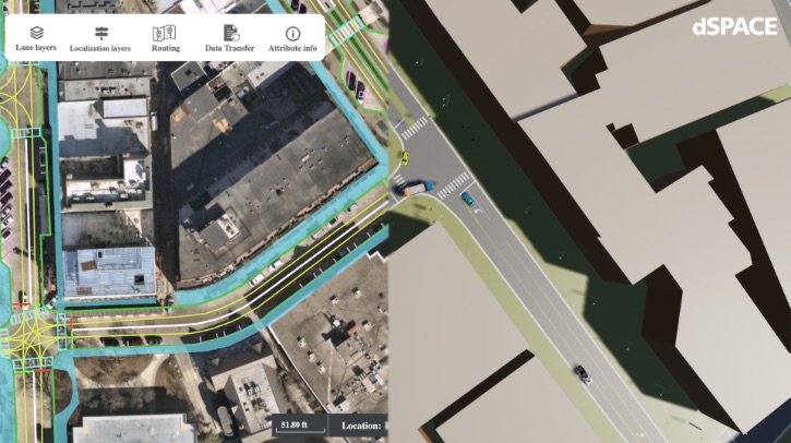
GeoMate is integrating its OpenDRIVE road network definitions and highly automated, consistent 3D models of the real-world environment into the dSPACE simulation ecosystem. The integration will help AV developers quickly carry out virtual test drives in scenarios based on high-resolution geographical image data. The collaboration will improve the accuracy, efficiency and reliability of the simulation and validation of autonomous vehicles.
“GeoMate creates compact HD maps for AD and ADAS systems and simulations with an innovative AI-based approach that increases speed, performance and cost-efficiency,” Dr Nastaran Saberi, CTO of GeoMate, commented.
Michael Kluge, product manager, scenarios, at dSPACE, added, “The seamless integration of GeoMate’s detailed, comprehensive maps into our Aurelion and ASM simulation solutions adds tremendous value for our customers and expands their ADAS/AD validation and sensor simulation capabilities.”
Verification and validation solutions, such as dSPACE’s Automotive Simulation Models ASM and Aurelion sensor simulation, are supported with simulation artifacts through cooperation with partners. Reality-based 3D environment models that accurately represent the semantics of the road are necessary to effectively validate autonomous driving and sensor functions.
The seamless integration of the ASAM OpenDRIVE format from GeoMate into dSPACE platforms allows users to work collaboratively with compatible testing and deployment software stacks.


